

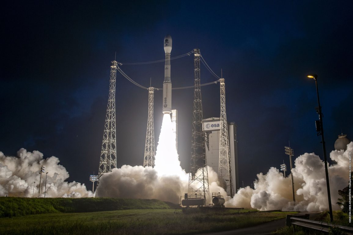
The European Space Agency (ESA) successfully launched its Biomass satellite aboard a Vega-C rocket today at 11:15 (CEST) from the Kourou spaceport in French Guiana. This mission marks a significant milestone in space exploration, as the Biomass satellite is designed to map the Earth’s biomass with unprecedented detail. With its innovative technology, this satellite will contribute greatly to our understanding of global carbon cycles, crucial for climate science.
Satellite’s Radar Antenna Maps Biomass and Carbon by Penetrating Forest Canopies Effectively
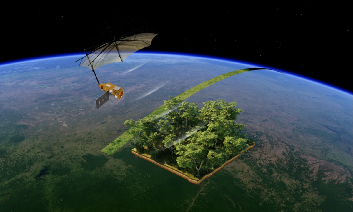
Once in orbit, the Biomass satellite will deploy a large radar antenna resembling a giant space umbrella. Developed by L3 Harris, the antenna is highly intricate and will take approximately nine days to unfold fully. This antenna is designed to direct radar pulses from a P-band radar instrument mounted on the satellite’s body down to the Earth’s surface. The P-band radar is particularly effective at penetrating thick forest canopies, reaching the woody structures beneath where most forest carbon is stored.
 ESA’s Biomass Satellite Launches to Map Forest Carbon and Unlock Climate Change Insights from Space
When the radar signals hit the Earth’s surface, they reflect back toward the satellite, where the umbrella-shaped antenna collects the returning signals. These signals are processed by the satellite’s onboard systems to create highly detailed 3D maps of global biomass. This process is similar to an MRI scan for forests, offering an innovative way to measure the structure and carbon content of forests across the globe.
Revolutionizing Carbon Tracking and Ecosystem Mapping for Climate Change Insights and Solutions
The satellite’s data could revolutionize our understanding of forest carbon. Forests are vital to the Earth’s carbon cycle, absorbing approximately 8 billion tonnes of CO2 annually. However, deforestation or damage to trees can release stored carbon back into the atmosphere, exacerbating climate change. By offering detailed, real-time measurements of biomass and carbon content, the Biomass satellite could play a key role in tracking deforestation and understanding how carbon moves within forest ecosystems.
In addition to monitoring forests, the Biomass satellite can also map subsurface geology in deserts, ice sheet structures, and forest floor topography, providing valuable insights into various ecosystems. By offering precise measurements of biomass, height, and carbon content, the probe has the potential to assist scientists in monitoring forest growth, deforestation, and the broader environmental impact of human activities. This mission represents a major step forward in the fight against climate change.